RTK GNSS vs PPK: Which is Best for Survey-Grade Drone Mapping in India?
Arjun Mehta
Head of Geospatial Solutions, Autoabode · Autoabode
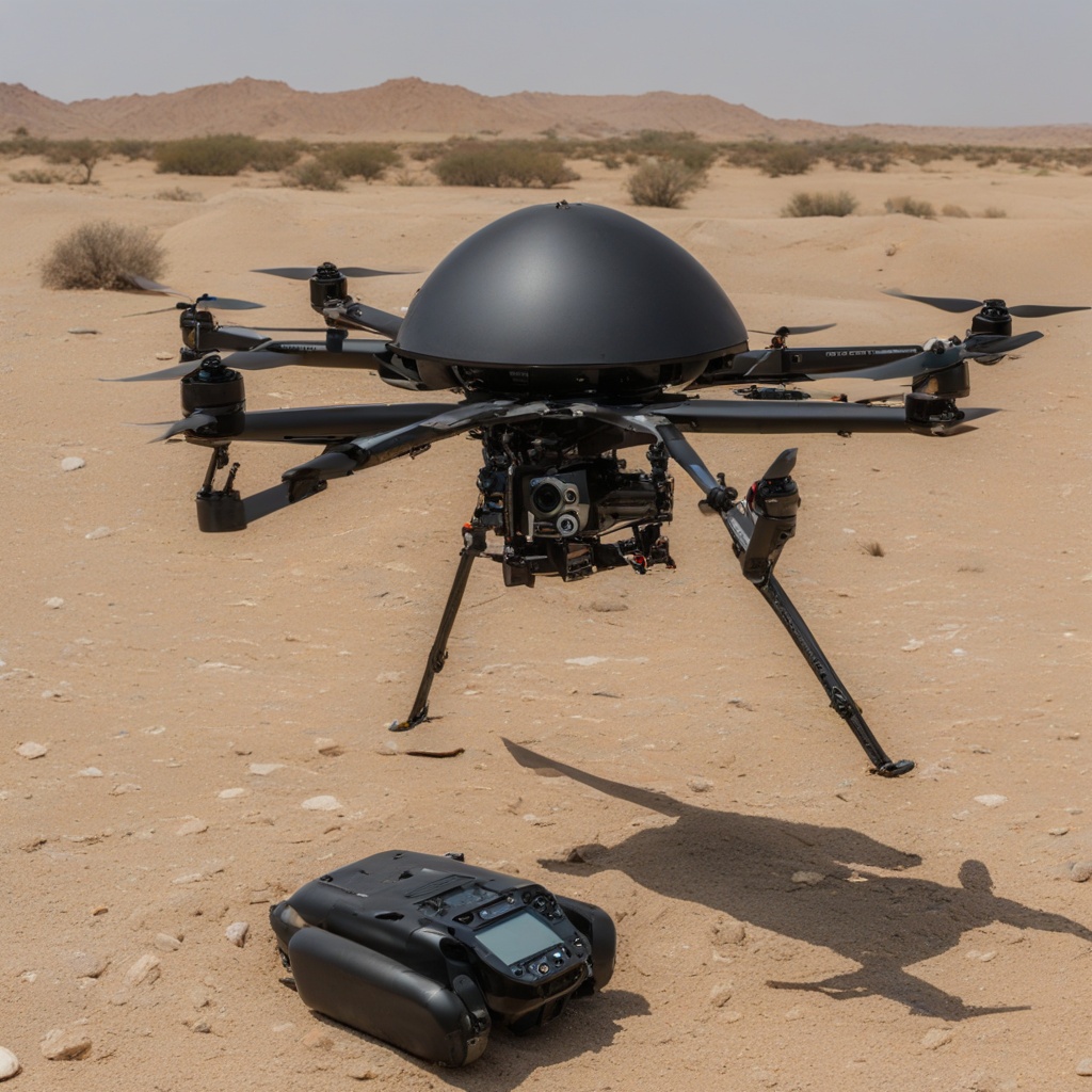
For professionals in India's rapidly growing drone mapping sector—from infrastructure planners to mining surveyors—the debate between RTK (Real-Time Kinematic) and PPK (Post-Processed Kinematic) GNSS is central to achieving survey-grade accuracy. The core question of RTK vs PPK drone mapping accuracy in India isn't just about technology; it's about selecting the right tool for the subcontinent's diverse and often challenging environments, where projects must comply with stringent standards from bodies like the Survey of India. At Autoabode, where our BotBit UAV series is deployed for critical national projects, we've validated both systems in conditions ranging from the Himalayan foothills to dense urban canyons. The choice impacts everything from absolute positional accuracy, often required to be under 2 cm for cadastral surveys, to operational efficiency in areas with poor cellular connectivity for RTK corrections. This analysis cuts through the marketing to provide a data-driven comparison, helping you decide which GNSS methodology delivers the required precision, reliability, and cost-effectiveness for your specific Indian project.
Understanding RTK: Real-Time Precision with a Signal Catch
How RTK GNSS Works in Drone Operations
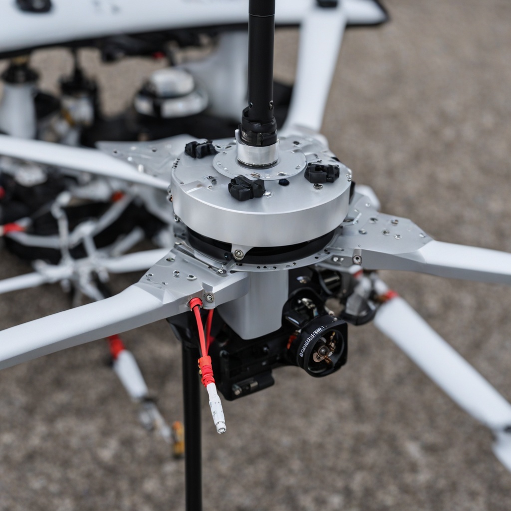
RTK technology provides centimeter-level accuracy by using a fixed base station on the ground to broadcast real-time correction signals to the drone's rover receiver during flight. This system calculates positional errors by comparing the base station's known coordinates with its GNSS readings, then instantly transmits corrections via radio link (typically 900 MHz or 2.4 GHz) or cellular network (NTRIP). In Autoabode's production trials with the BotBit Pro UAV, integrating a dual-frequency RTK module (L1/L2 bands) reduced raw GNSS error from several meters to a consistent 1-2 cm horizontally and 2-3 cm vertically in real-time. The immediate benefit is that each captured image is already geotagged with high-accuracy coordinates, streamlining the workflow by eliminating a separate post-processing step. This is crucial for applications like construction stakeout or volumetric monitoring where real-time data is actionable.
However, the 'real-time' advantage of RTK is entirely dependent on maintaining a stable, uninterrupted communication link between the base and the rover. In India, this presents significant challenges. Terrain like dense forests, urban high-rises, or remote mining sites can block radio signals. While cellular NTRIP networks offer wider coverage, they are unreliable in rural or mountainous regions—precisely where many large-scale surveys occur. Our engineers at Autoabode have observed that signal loss, even for brief periods, can cause the drone to revert to standard GNSS accuracy, potentially corrupting an entire mission's positional data. Furthermore, setting up a physical base station within optimal range (usually under 10-15 km for reliable radio link) adds time, cost, and logistical complexity to each survey day, requiring trained personnel and secure site selection.
Autoabode's field data shows RTK signal dropout rates can exceed 15% in typical Indian urban or hilly terrain, risking key image positions reverting to 2-5 meter accuracy without warning.
- Requires continuous communication link (radio/NTRIP) between base station and UAV.
- Delivers real-time corrected coordinates, enabling on-the-fly verification and stakeout.
- Vulnerable to signal interruption from terrain, infrastructure, or radio interference.
- Adds operational overhead: base station setup, licensing for NTRIP services, and link monitoring.
- Optimal range is typically limited to 10-15 km from the base station for reliable correction quality.
The PPK Alternative: Robust Accuracy After the Flight

The Post-Processed Workflow for Maximum Reliability
PPK (Post-Processed Kinematic) takes a different approach. Both the drone and a ground base station record raw, un-corrected GNSS observation data (carrier-phase and code) throughout the flight. No correction data is transmitted in real time. After the mission, these two logs are processed together using specialized software, which computes the precise trajectory of the drone. This method is inherently more robust for Indian conditions because it removes the dependency on a real-time communication link. The drone can fly behind obstructions, in deep quarries, or far beyond line-of-sight of the base station without any degradation in potential accuracy. Clients including DRDO report that for large, linear projects like pipeline or highway corridor mapping, PPK allows a single base station to cover vastly larger areas—sometimes 50+ km—as the drone only needs to start and end its flight with the base logger running.
The trade-off is temporal. Since processing occurs after the flight, there is no immediate validation of positional accuracy in the field. This requires strict flight discipline: ensuring the base station logs correctly, verifying raw data integrity post-flight, and allocating time for computational processing. However, modern software has automated much of this. The post-processing itself leverages sophisticated algorithms to fix integer ambiguities and filter noise, often yielding slightly better final accuracy than RTK—commonly achieving 1 cm horizontal and 1.5 cm vertical accuracy in controlled tests. For mission-critical mapping where every data point must be defensible, such as for legal cadastral surveys or evidence-grade documentation, the PPK workflow provides an auditable data trail from raw logs to final coordinates.
Indian Survey Context: Regulations, Terrain & Autoabode's Integrated Solutions
Choosing between RTK and PPK in India isn't purely technical; it's contextual. The DGCA's UAS Rules 2021 and geospatial guidelines mandate specific accuracy standards for different applications. Furthermore, initiatives like the PM GatiShakti National Master Plan demand seamless, highly accurate geospatial data for infrastructure planning. In rugged or remote terrain—common in mining, hydropower, or border area surveys—PPK's signal independence is a decisive advantage. Conversely, for time-sensitive urban projects or rapid response missions, RTK's real-time output can accelerate decision-making. At Autoabode, we've engineered our BotBit UAV series to offer flexible, integrated solutions. Our high-endurance BotBit Surveyor model can be configured with a hybrid RTK/PPK GNSS module, allowing pilots to use RTK when conditions permit for immediate results, while simultaneously recording raw data for guaranteed PPK fallback processing. This dual-logging capability ensures no mission is compromised by signal loss. Furthermore, our data processing pipelines, often used in conjunction with outputs from our SLS 3D printers for creating precise terrain models, are optimized for both correction methods, ensuring seamless integration into CAD and GIS workflows required by major Indian contractors and government agencies under the DAP 2020 procurement framework. For specialized applications like monitoring stockpiles or creating digital twins of industrial sites, this accuracy is paramount. Explore our BotBit UAV series to see drones built for India's mapping challenges, or learn about our end-to-end rapid prototyping services for custom sensor payloads and ground control targets.
Frequently Asked Questions
Q: What is the main difference between RTK and PPK drones?
A: The core difference lies in when the GNSS correction is applied. RTK (Real-Time Kinematic) corrects the drone's position in real-time during the flight using a live data link from a base station. PPK (Post-Processed Kinematic) records raw satellite data during the flight and applies the corrections in software after the mission. RTK gives you immediate, corrected coordinates but requires a stable communication link. PPK is more reliable in areas with poor connectivity (like forests or near tall buildings) because it doesn't need a live link, but you only get the accurate positions after processing the data on a computer. For survey-grade work in India, PPK is often preferred for its robustness against signal loss.
Q: Which is more accurate, RTK or PPK?
A: In ideal conditions with perfect signal continuity, both methods are capable of achieving very similar high accuracy—typically 1-2 cm horizontally and 2-3 cm vertically. However, PPK often has a slight edge in achievable final accuracy because the post-processing software can use more advanced filtering and has the benefit of 'future' satellite data to resolve errors. More importantly, PPK is consistently accurate because it is not subject to the real-time signal dropouts that can plague RTK in challenging environments. In Autoabode's validation tests, PPK processing consistently yielded results with a standard deviation under 1.5 cm, whereas RTK performance could vary based on local interference.
Q: Do I need ground control points (GCPs) with RTK/PPK drones?
A: While RTK and PPK significantly reduce the need for a dense network of ground control points (GCPs), using a few well-distributed checkpoints is considered a best practice for absolute accuracy validation. RTK/PPK provides high relative accuracy between points in your model, but a small number of GCPs (3-5 for a typical site) verify and correct for any residual systematic errors in the GNSS system or the drone's internal measurements. This creates a robust, auditable survey. For the highest accuracy mandates, such as those required by the Survey of India, a combination of PPK-derived positions and a minimal set of surveyed GCPs is the recommended and most reliable workflow.
Q: Is PPK or RTK better for drone mapping in mountains?
A: For mountain, hilly, or heavily forested terrain in India, PPK is generally the superior and more reliable choice. The primary reason is signal obstruction. RTK requires a clear, continuous communication link between the base station and the flying drone, which is frequently broken by ridges, valleys, and dense canopy. PPK eliminates this vulnerability because the drone and base station simply log data independently; no link is needed during flight. This allows the drone to map behind mountains or in deep valleys without any loss of potential accuracy. The base station can also be placed in a location with a clear sky view for optimal data logging, regardless of where the drone is flying.
The choice between RTK and PPK for drone mapping in India ultimately hinges on your project's specific demands for speed, reliability, and operational environment. For rapid, real-time data acquisition in open areas with good connectivity, RTK offers a streamlined workflow. For the utmost in reliable, auditable, survey-grade accuracy across India's diverse and challenging landscapes—from the Thar Desert to the Western Ghats—PPK provides an indispensable safety net. At Autoabode, we design our geospatial solutions, including the BotBit UAV platform, to empower professionals with this choice, ensuring that national projects from urban planning to defense infrastructure are built on a foundation of precise, trustworthy data. Ready to specify the right system for your mission? Contact Autoabode's survey team to discuss your requirements and schedule a demonstration.
Frequently Asked Questions
The core difference lies in when the GNSS correction is applied. RTK (Real-Time Kinematic) corrects the drone's position in real-time during the flight using a live data link from a base station. PPK (Post-Processed Kinematic) records raw satellite data during the flight and applies the corrections in software after the mission. RTK gives you immediate, corrected coordinates but requires a stable communication link. PPK is more reliable in areas with poor connectivity (like forests or near tall buildings) because it doesn't need a live link, but you only get the accurate positions after processing the data on a computer. For survey-grade work in India, PPK is often preferred for its robustness against signal loss.
Arjun Mehta
Head of Geospatial Solutions, Autoabode · Autoabode Consumer Electronics Pvt. Ltd.
Expert author at Autoabode — writing at the intersection of industrial 3D printing, defence manufacturing, and advanced UAV systems. Based in New Delhi, India.
Explore Autoabode's Platforms
This article is part of Autoabode's technical journal. Learn more about our core platforms built in India for defence, aerospace, medical and industrial teams:
More from the Journal
Off-Grid Communication Solutions for Mountainous Terrain: An Engineering Field Guide for India's High-Altitude Operators
Off-grid communication solutions for mountainous terrain are not optional in India — they are the difference between a coordinated operation and a stranded section. This engineering field guide breaks down the radio physics that defeats conventional VHF/UHF in the Himalayas, the mesh architectures that survive ridge-line shadowing, and the cold-weather, power-budget and security trade-offs that determine whether a system delivers in the Karakoram and Western Ghats. Built around real deployment data from Autoabode's MeshVani encrypted communicator and MeshVani Relay platform in service with the Indian Army, ITBP, NDRF and high-altitude expedition teams.
Drones & UAV · 7 min readModular UAV Payloads for Multi-Role Missions: A Technical Guide
Explore the technical specifications and strategic advantages of modular UAV payloads for multi-role missions. This guide covers hot-swap systems, sensor fusion, and real-world applications for defense and industry.